Road infrastructure is a critical component of any economy, ensuring smooth transportation for people and goods. However, without proper monitoring and maintenance, roads deteriorate over time, leading to higher repair costs, unsafe travel conditions, and inefficient infrastructure planning.
To tackle these challenges, we have developed a Road Maintenance System, a modern geolocation-based application that helps government agencies, contractors, and private road owners efficiently monitor road conditions, plan maintenance, and estimate costs based on real-time data.
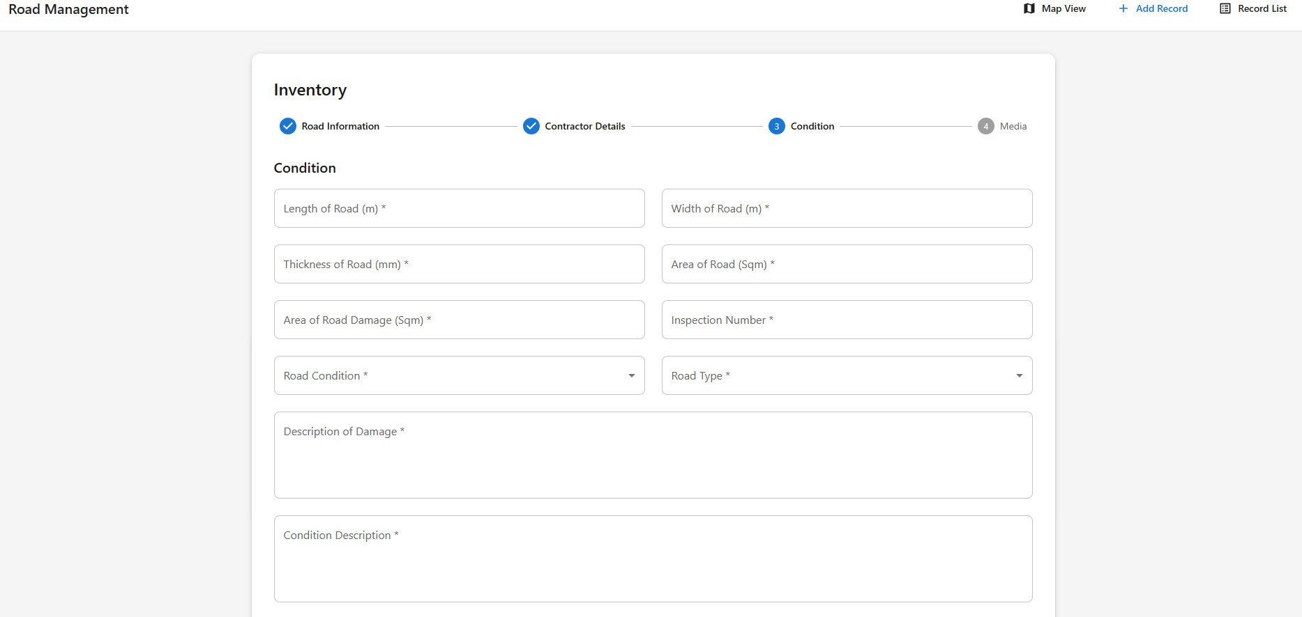
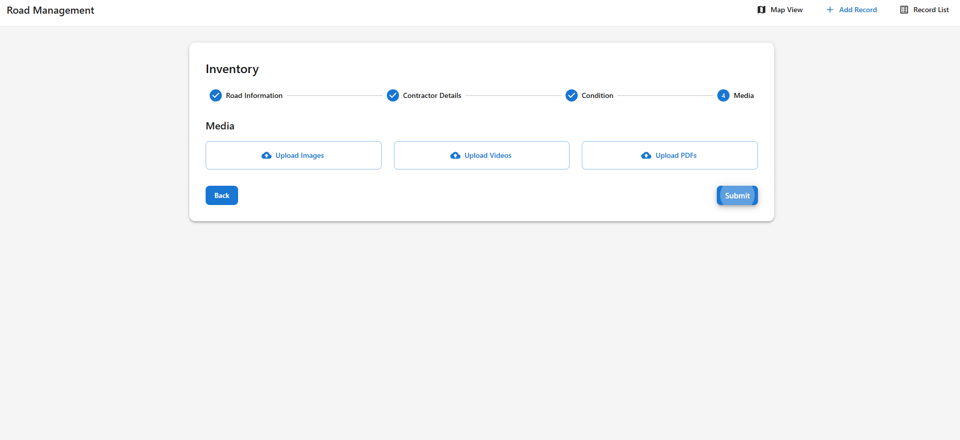
Our Road Maintenance System is a smart, data-driven solution that collects road inventory, geolocation, construction details, and condition reports, including images and videos.
🚧 Key Features:
✅ Real-time Geolocation Mapping (powered by Mapbox)
✅ Road Condition Monitoring & Criticality Filters
✅ Automated Repair Cost Estimation
✅ Interactive Reports & Historical Data
✅ Role-Based Access for Admins & Contractors
✅ Secure Data Storage with PostgreSQL & AWS
🌟 Impact: This system saves time, reduces costs, and ensures that road maintenance funds are used effectively by prioritizing worst-condition roads first.
🔹 Step 1: Admin/Contractor logs in securely.
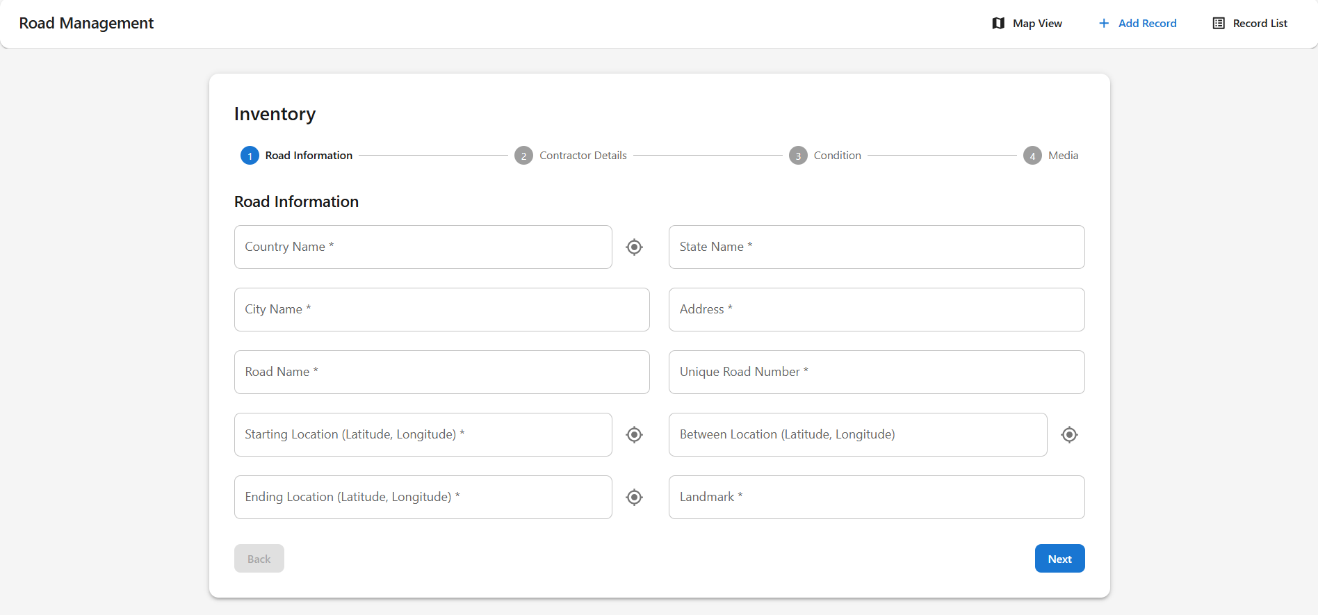
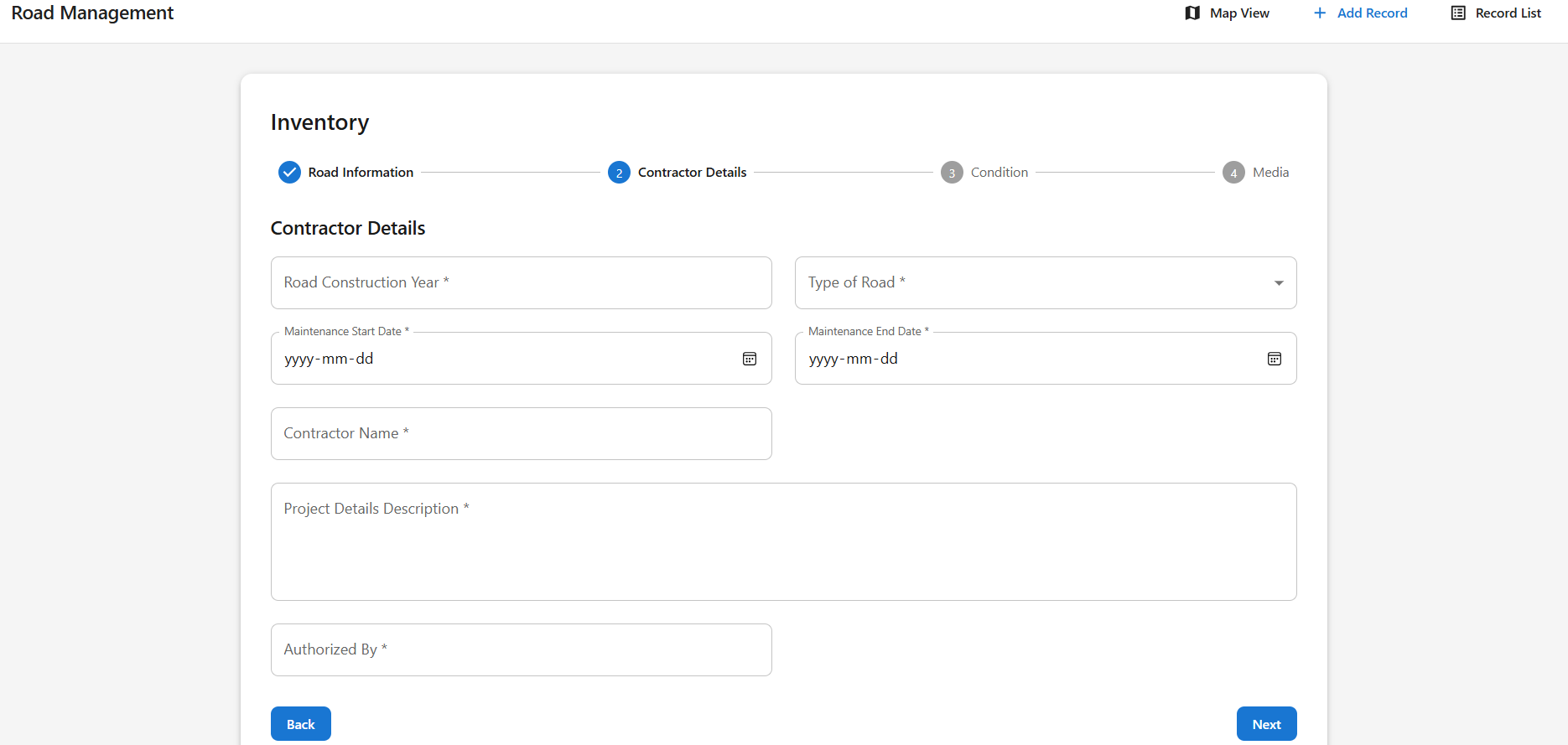
🔹 Step 2: The system collects road inventory data, location, and images/videos.
🔹 Step 3: A dynamic map visualizes roads based on their condition.
🔹 Step 4: Users can filter roads by criticality and view historical reports.
🔹 Step 5: The system provides repair cost estimates for each damaged road.
💡 Result? Smart decisions on which roads to fix first, leading to better road quality and cost savings.
| Feature | Description |
|---|---|
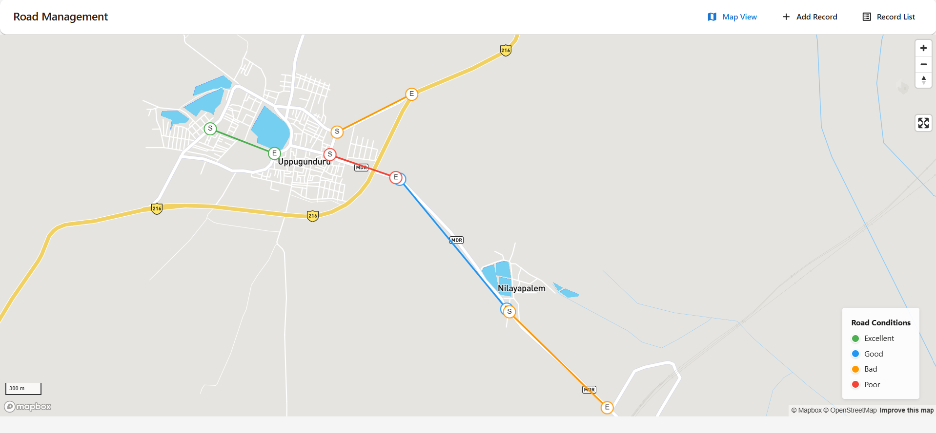
| 📍 Geolocation Mapping | See road details on an interactive map (powered by Mapbox). |
| 📊 Criticality-Based Filters | View roads based on condition rankings (Excellent🟢, Good 🟡, Bad🟠, Poor🔴). |
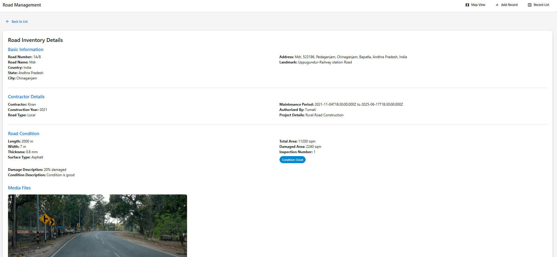
| 📷 Image & Video Reports | Upload real-time photos/videos of road conditions. |
| 🛠️ Maintenance History | Track road repairs, contractors, and maintenance periods. |
| 📑 Automated Cost Estimation | Estimate repair costs based on road conditions. |
| 🔐 Role-Based Access Control | Admins can manage data, contractors can upload reports. |
Our system leverages Mapbox to provide a detailed geospatial view of roads. Users can:
The system allows for easy submission of road condition data, including:
Rather than relying on a fixed maintenance span, the system uses:
✅ Condition-based ranking to prioritize the worst-affected roads first.
✅ Historical analysis to estimate future maintenance needs.
✅ Smart budgeting tools that help allocate funds efficiently.
This ensures that resources are spent effectively, reducing unnecessary expenses.
Administrators can:
This system is built with a modern technology stack to ensure efficiency, scalability, and performance.
| Component | Technology Used |
|---|---|
| Frontend | React + Vite + TypeScript |
| Backend | Node.js with Express (REST API) |
| Database | PostgreSQL + PostGIS (for geospatial data) |
| Mapping | Mapbox for road visualization |
| Cloud Storage | AWS for storing images, videos, and reports |
This stack ensures fast performance, secure data handling, and an intuitive user experience.
💡 Government Agencies – Plan road maintenance and allocate resources efficiently.
💡 Private Road Owners – Keep track of road conditions and optimize maintenance costs.
💡 Contractors – Access historical project details and monitor repair schedules.
💡 Urban Planners – Improve city infrastructure by identifying high-risk road conditions.
🚀 Reduces Maintenance Costs – Focuses on repairing the worst-damaged roads first.
🛠 Enhances Road Safety – Reduces accidents by keeping roads in optimal condition.
📊 Data-Driven Decision Making – Helps in budgeting and planning roadwork efficiently.
🌍 Improves Infrastructure Longevity – Ensures long-term durability of roads.
We plan to introduce AI-based road condition assessment and automated cost estimations based on damage severity. Additionally, mobile app integration will allow field engineers to capture and submit real-time road conditions directly from their smartphones.
The Road Maintenance System is a powerful solution for government bodies, contractors, and private road owners to efficiently manage road conditions. By leveraging geospatial data, predictive analytics, and smart mapping tools, this system helps optimize maintenance efforts, reduce costs, and improve road safety.
🚀 Join us in revolutionizing road maintenance with technology! 🚀
We are in the final stages of deployment and will soon be launching the LIVE version of the system.
✅ Follow us for updates.
✅ Be the first to test the live system.
✅ If you are a government official, contractor, or road owner, this tool is for you!
🔜 Coming Soon – Stay Tuned! 🚀
💬 Drop a message or reach out for a personalized demo of the system!
🚀 Road maintenance just got smarter! 🌍